Consider the following pairs:
Contents17
Consider the following pairs:
| Protected Area / Peak | State | |
|---|---|---|
| 1. | Dampa Tiger Reserve | Mizoram |
| 2. | Gumti Wildlife Sanctuary | Sikkim |
| 3. | Saramati Peak | Nagaland |
Which of the above pairs is/are correctly matched?
- A1 only
- B2 and 3 only
- C1 and 3 only
- D1, 2 and 3
Show answer
Answer: (C) 1 and 3 only
Pair 1 — CORRECT:
Dampa Tiger Reserve is in Mizoram (western Mizoram, near the Bangladesh border).
It's one of the largest wildlife reserves in the North-East.
Pair 2 — WRONG:
Gumti Wildlife Sanctuary is in Tripura, NOT Sikkim.
It is located around the Dumbur Lake (Gumti river reservoir) in Tripura.
Sikkim's protected areas include Khangchendzonga NP and Fambong Lho WLS.
Pair 3 — CORRECT:
Saramati Peak (3,841 m) is the highest peak of Nagaland, located on the Nagaland-Myanmar border.
It is the highest peak in the Naga Hills.
Memory tip for NE India:
Learn one key protected area and one key peak per state — UPSC loves NE geography.
Northeast India has 7 states with distinct protected areas and peaks that UPSC frequently tests to check if students can differentiate between these geographically similar states.
Gumti Wildlife Sanctuary is in Tripura around Dumbur Lake, not in Sikkim - this is a common confusion trap since both are small northeastern states.
The question tests precise state-wise mapping of protected areas and peaks, requiring students to memorize at least one key protected area per northeastern state.
Dampa Tiger Reserve
Geography Dampa Tiger Reserve Mizoram
Dampa Tiger Reserve: Location & Key Features
Located in western Mizoram near Bangladesh border
Largest wildlife reserve in Northeast India
Established in 1994 as tiger reserve
Strategic Location
Dampa Tiger Reserve sits in western Mizoram, forming a natural corridor near the Bangladesh border. This location makes it ecologically significant for trans-boundary wildlife conservation.
Key Features
Covers 500 sq km of tropical forest
Home to tigers, leopards, elephants and over 150 bird species
Contains Dampa Wildlife Sanctuary within its core area
Part of the Indo-Myanmar biodiversity hotspot
Location Map

Source: Naparks — Dampa Tiger Reserve » Naparks · naparks.com
Don't confuse with Namdapha (Arunachal Pradesh) - another major NE tiger reserve
Remember it's in western Mizoram, not eastern side near Myanmar
Gumti Wildlife Sanctuary
Geography Gumti Wildlife Sanctuary Sikkim
Gumti Wildlife Sanctuary: Tripura's Key Protected Area
Located in Tripura, NOT Sikkim
Surrounds Dumbur Lake (Gumti river reservoir)
Established in 1988
Location Clarity
Gumti Wildlife Sanctuary is in Tripura, built around the Dumbur Lake formed by damming the Gumti river. The UPSC question incorrectly placed it in Sikkim - a classic geography trap.
Gumti vs Sikkim Sanctuaries
Protected Area | Actual State | Key Feature |
|---|---|---|
Gumti Wildlife Sanctuary | Tripura | Around Dumbur Lake |
Khangchendzonga National Park | Sikkim | Around Mt. Khangchendzonga |
Fambong Lho Wildlife Sanctuary | Sikkim | Near Gangtok |
Sanctuary Details
Covers 389 sq km around artificial Dumbur Lake
Habitat for primates, elephants, wild boar
Important bird sanctuary with migratory species
Part of Gumti river catchment area
Major trap: Gumti is in Tripura, not Sikkim - exactly what this question tested
Don't mix up Gumti river (Tripura) with Teesta river (Sikkim)
Saramati Peak
Geography Saramati Peak Nagaland
Saramati Peak: Nagaland's Highest Point
Highest peak of Nagaland at 3,841 meters
Located on Nagaland-Myanmar border
Part of the Naga Hills range
Border Location
Saramati Peak (3,841 m) stands as Nagaland's highest point on the international border with Myanmar. It forms part of the Naga Hills that extend across the India-Myanmar boundary.
Northeast India Highest Peaks
Peak | State | Height (m) | Location |
|---|---|---|---|
Khangchendzonga | Sikkim | 8,586 | Sikkim-Nepal border |
Saramati | Nagaland | 3,841 | Nagaland-Myanmar border |
Gorichen | Arunachal Pradesh | 6,488 | Near Tawang |
Blue Mountain | Mizoram | 2,165 | Champhai district |
Geographic Significance
Forms watershed between India and Myanmar
Part of Arakan mountain system
Strategic location for border security
Trekking destination in Nagaland
Peak Location
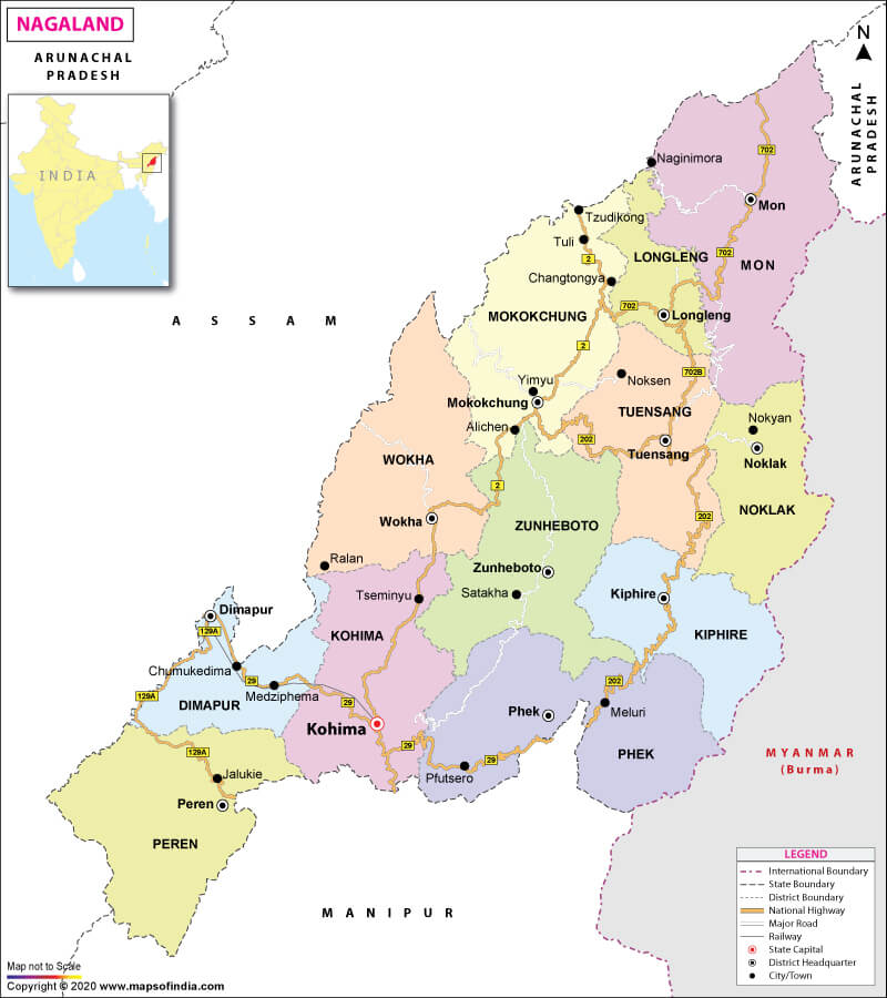
Source: India Map — What are the Key Facts of Nagaland? | Nagaland Facts - Answers · www.mapsofindia.com
Remember the height: 3,841 m - UPSC may test this number
Don't confuse with Doddabetta (Tamil Nadu) or Anamudi (Kerala) - different regions entirely
Northeast India Protected Areas
Geography
Northeast India Protected Areas: State-wise Distribution
7 Northeast states have major protected areas
Part of Indo-Burma biodiversity hotspot
Home to unique flora and fauna not found elsewhere in India
Regional Importance
Northeast India forms part of the Indo-Burma biodiversity hotspot, making its protected areas crucial for global conservation. UPSC frequently tests the state-wise distribution of these sanctuaries and parks.
Key Protected Areas by State
State | Major Protected Area | Type | Special Feature |
|---|---|---|---|
Mizoram | Dampa Tiger Reserve | Tiger Reserve | Largest in NE, Bangladesh border |
Tripura | Gumti Wildlife Sanctuary | Wildlife Sanctuary | Around Dumbur Lake |
Sikkim | Khangchendzonga National Park | National Park | UNESCO World Heritage Site |
Arunachal Pradesh | Namdapha National Park | National Park | Only park with 4 big cats |
Assam | Kaziranga National Park | National Park | One-horned rhinoceros |
Manipur | Keibul Lamjao National Park | National Park | Only floating park in world |
Nagaland | Intanki National Park | National Park | Hoolock gibbons |
Conservation Challenges
Cross-border wildlife movement with Myanmar and Bangladesh
Jhum cultivation pressure on forest areas
Insurgency issues affecting conservation efforts
Climate change impact on fragile ecosystems
Don't swap states: Gumti is Tripura, Dampa is Mizoram - memorize this pairing
Kaziranga is Assam, Manas is also Assam - don't place in other NE states
Namdapha (Arunachal) vs Dampa (Mizoram) - both are tiger reserves but different states